Overview
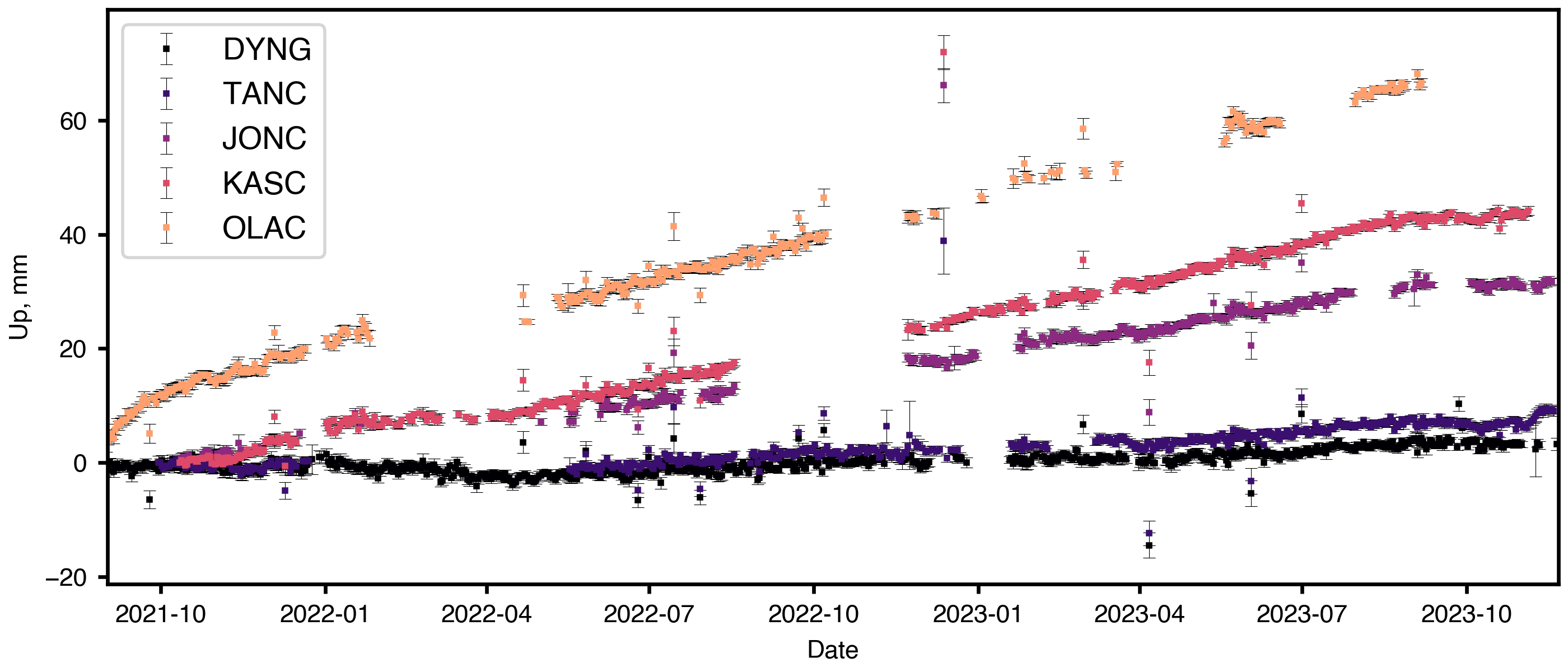
Askja volcano—situated in Iceland's Northern Volcanic Zone—last erupted in 1961, when a 0.7 km-long fissure opened up, releasing 500 m-high lava fountains. In the intervening decades, the caldera-forming volcano has been deflating at a decaying rate. In August 2021, this trend rapidly reversed and Askja began to reinflate, with over 0.5 m of uplift observed at the center of inflation. Geodetic modeling of the available InSAR and GNSS positioning data has revealed a shallow sill-like magmatic source can explain the observed deformation, but the exact origin of the magma remains unclear. Recent modeling of a number of recent eruptions has shown that changes in the subsurface distribution of magma can produce a measurable change in the local magnetic field at the surface, but there are few to no datasets that capture such events in-situ making the modeling approach difficult to validate. We propose to install a campaign network of passive magnetometers in and around Askja to capture the changes in the local magnetic field due to the continued influx of magma into the shallow crust. With these data we will establish the value of such networks in volcanic systems, while also providing additional constraints for models that combine concurrent gravity surveys and continuous GNSS positioning observations.
Broader Impacts
The magnetometry technique that we wish to test could significantly improve the capacity of civil defense authorities to prepare for volcanic eruptions. All plans and source code will be publicly available and open source. The magnetometry data can also be used to determine where more expensive instruments should be placed, increasing the effectiveness of existing instrument networks. The success of this project could bring high-quality volcanic risk-mitigation to all.
Repository: https://github.com/hemmelig/NSF-RAPID-EAR-2333178